Every player of world guessing games like GeoGuessr knows the feeling. You spawn on a flat, empty road with no signs, no people, and a horizon that could easily belong to three different continents. The panic sets in as the timer ticks down.
While some locations offer immediate clues — like a Parisian café or a New York yellow cab — others are notoriously designed to make you lose points. According to top players, the hardest countries to guess aren't always the most obscure. Often, they are the massive, sprawling nations that share "lookalike" biomes with their neighbors.
Here are the 10 hardest countries to guess in Street View geography games, and the visual traps that make them so difficult.
#1 — Russia: The Endless Birch
Russia is widely considered the single hardest country in the game. Covering 17.1 million square kilometers, it is the largest country on Earth, and vast stretches of its landscape look entirely identical. If you are dropped on a snowy road surrounded by birch and pine trees, you could be in Siberia, but you could just as easily be in Scandinavia or Canada. The only reliable way to confirm Russia is to spot Cyrillic text.
#2 — Canada: The Boreal Twin
As the second-largest country on the planet, Canada's massive boreal forests are a dead ringer for Russia. Further south, the flat Canadian Prairies seamlessly blend into the American Midwest. Players frequently ruin perfect games by confidently clicking the wrong northern country when spawned on an endless, tree-lined highway.
#3 — Mongolia: The Empty Steppe
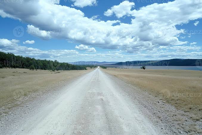
Mongolia fools players because its vast steppe is almost roadless, incredibly empty, and thinly mapped. Long stretches of gameplay consist of following a dirt track with nothing but grass, sky, and the occasional herd of livestock. With almost zero human infrastructure or signage, you are left looking for subtle camera generation clues or the Google car's camping gear to save you.
#4 — Australia: The Generic Outback
The sheer size of Australia means you can drive for hours in Street View without seeing a single defining landmark. The red dirt and dry brush of the Outback are iconic, but they can easily trick players into guessing South Africa or even parts of South America if they aren't paying close attention to road lines and driving sides.
#5 — Botswana: The Southern Africa Puzzle
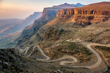
Southern Africa is a notoriously difficult region for geography games. Botswana is particularly tough because its flat, dry savanna blends seamlessly into neighboring Namibia, Zimbabwe, and South Africa. Players often realize they are in southern Africa based on the golden grass and thorny scrub, but end up clicking the wrong side of a border.
#6 — Indonesia: The Island Maze
Indonesia is scattered across roughly 17,000 islands, making region-guessing an absolute nightmare. The country is a repetition of tropical jungle, palm trees, and dense foliage. Its lush, tropical roads heavily resemble those of Malaysia, Thailand, and the Philippines, forcing players to rely on subtle architectural clues or pole designs.
#7 — Brazil: The South American Giant
Brazil ranges from the dense Amazon rainforest to the dry sertão plains and temperate southern regions. Because of this massive ecological diversity, one Brazilian road rarely looks like the next. It is very easy to confuse a dusty Brazilian road with nearby countries unless you spot Portuguese text.
#8 — Kazakhstan: The Second Steppe Trap
Kazakhstan is the ninth-largest country in the world, and much of it consists of flat, desolate steppe that perfectly mirrors both Russia and Mongolia. Empty highways under enormous skies give almost no geographical clues away. This creates a classic "somewhere in the middle of Asia" panic.
#9 — New Zealand: The Australia Mixup
New Zealand's rolling green hills and temperate climate often cause players to reflexively click the UK, Ireland, or Australia. The visual trap is strong, and if you can't spot the distinctive tree ferns or the majestic mountains of the South Island, it's very easy to assume you are in a completely different hemisphere.
#10 — Argentina: The Featureless Pampas
Argentina rounds out the list thanks to the Pampas — a vast, flat, and fenced grassland that is almost entirely featureless. Long stretches of rural Argentina look exactly like Uruguay or rural Chile. The lack of prominent landmarks leaves players leaning on incredibly small details, like a specific type of wooden fence post or the color of a license plate.
Conclusion
Improving your score in GeoGuessr or other Street View guessing games isn't about memorizing every flag in the world — it's about learning to separate the lookalike clusters. If you can learn the subtle differences that separate Russia from Canada, or Botswana from South Africa, your average score will skyrocket. The next time you spawn on an empty dirt road, don't panic. Just look a little closer at the dirt, the trees, and the poles.
Frequently Asked Questions
What is the hardest country to guess in street view?
What are the top 10 hardest countries to guess?
How can I get better at guessing hard countries?
How do I tell Russia from Canada in street view?
Test Yourself on These Tricky Locations
Play LostStreet and see if you can identify these difficult countries — 100% free, no sign-up required.
Play LostStreet Free